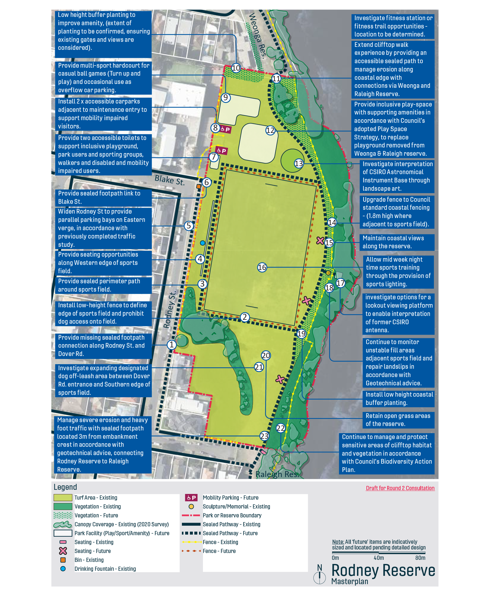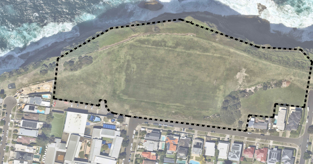
Did you know your daily dog walk sits directly above the spot where scientists first mapped the center of our galaxy? Every morning, locals gather at Rodney Reserve to exercise, walk dogs, and take in panoramic views of the Tasman Sea. Below the turf lies one of the most remarkable chapters in modern science.
The Underground Legacy of Dover Heights Science
Between 1946 and 1954, the Commonwealth Scientific and Industrial Research Organisation (CSIRO) repurposed former World War II coastal radar facilities atop the Dover Heights cliffs into a world-leading radio astronomy field station.
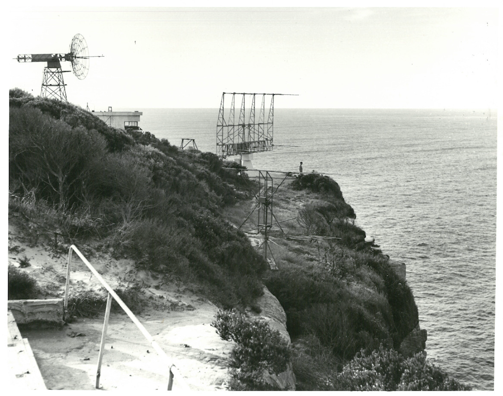
Pioneering researchers, including John Bolton, Gordon Stanley, Bruce Slee, and Ruby Payne-Scott, worked out of the coastal outpost. In 1951, after requests for funding to construct a larger antenna were knocked back, Bolton, Stanley, and Slee spent three months of lunch breaks manually digging a 21.9-metre dish into the sand dune. They lined the depression with ash, packing-case metal strips, and a central mast.
Using this handmade instrument, the team proved that radio emissions originated from distant extragalactic sources and nebulae. Their precise tracking of Sagittarius A led the International Astronomical Union in 1958 to establish the official zero-point coordinate of the Milky Way galaxy based on calculations taken at Rodney Reserve.


Waverley’s Balancing Act on the Clifftops
Waverley Council is finalising its Coastal Reserves Plan of Management, which seeks to honor this global scientific heritage while upgrading local recreational facilities.
Public consultations revealed a tension between structural memorialisation and open-space preservation. Council evaluated two main design proposals to commemorate the CSIRO site:
- Option 1 ($2.2M): A cantilevered lookout projecting over the eastern cliff crest to view a replica antenna array. Geotechnical assessments raised major concerns regarding cliff instability, landslip threats, and severe wind loading.
- Option 2 ($450k): A sunken concrete landscape intervention set landward in the northern turf. Designed to interpret the historic 1951 dish, it avoids high-risk geohazard zones and doubles as an interactive community space.
Residents generally favor retaining unobstructed grass, ocean views, and quiet parkland over heavy built infrastructure.
Details regarding these proposed options and ongoing community engagement are published on the official Waverley Council Have Your Say Portal.
Upgrades, Fencing, and Geotechnical Management
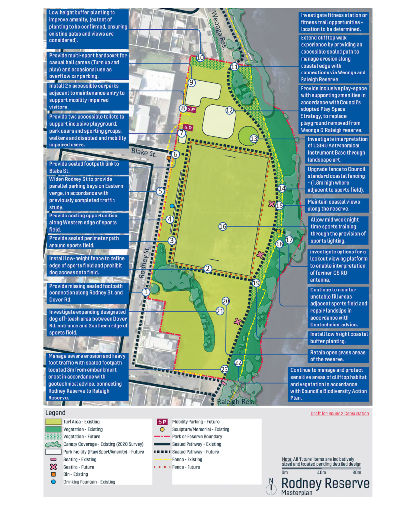
The broader draft Masterplan addresses long-standing operational issues across the parkland:
- Sports Facilities: Provision of sports lighting to enable mid-week nighttime training, a multi-sport hardcourt for casual play, and an inclusive play-space.
- Access & Fencing: Sealed perimeter footpaths around the sports field, improved links to Blake Street and Rodney Street, low-height fencing to keep dogs off active turf, and dedicated off-leash zones.
- Coastal Integrity: Realignment of footpaths three metres back from embankment crests, ongoing monitoring of unstable fill, and habitat protection under Council’s Biodiversity Action Plan.
Next Steps for the Masterplan
Community feedback gathered through the Have Your Say consultation portal is currently under evaluation by Council planners and geotechnical engineers. A refined Plan of Management will be presented at an upcoming formal meeting for official adoption before construction funding is allocated.
Published 25-Sept-2026